3 thoughts on “Aerial View of HighStreet and Norwood c1969. Courtesy of Neil Emsen”
The left photograph was taken over the Delves. In id-ground the church can be seen. The lighter area is the then new housing between primary school and canal. Sheffield Road can seen behind as can Rotherham Road and the two Norwood estates.
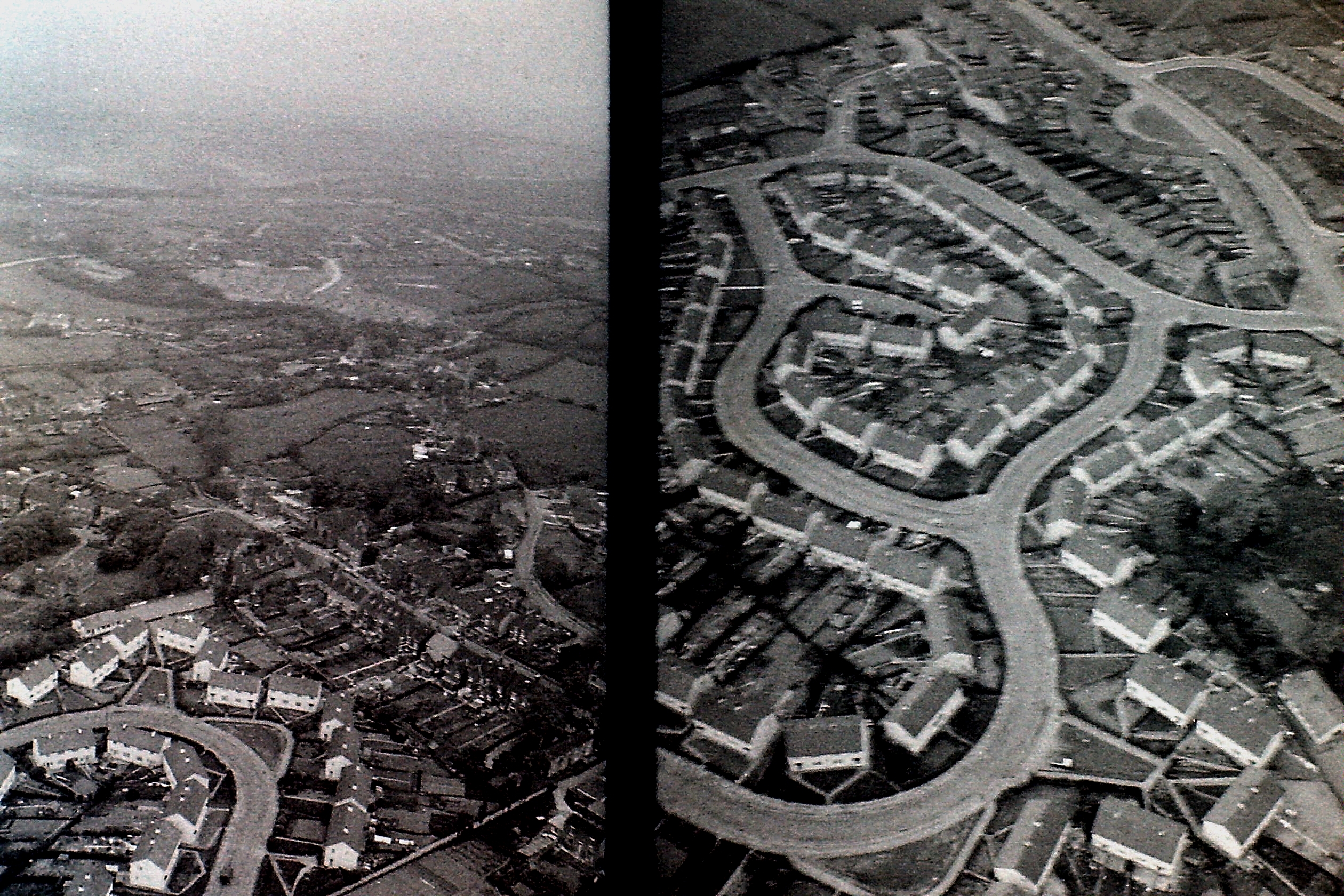
The left photograph was taken over the Delves. In id-ground the church can be seen. The lighter area is the then new housing between primary school and canal. Sheffield Road can seen behind as can Rotherham Road and the two Norwood estates.
where about in Norwood is the above photo taken looks a lot like white city
Aerial view of High Street and Norwood.
Details from Sgt Neil Emsen’s logbook:
Date: 17 May 1971
Type: Whirlwind HAR 10
Reg No: XP 299
Pilots: Flt Lt G-William/ P Off Hopkirk
Crewman: Sgt Emsen
Route: RAF Wittering – Low Flying in Area 8 – RAF Finningley – Low Flying in Area 8 – RAF Wittering
Flight Time: 2 hours 55 minutes.